{Back to top of page}
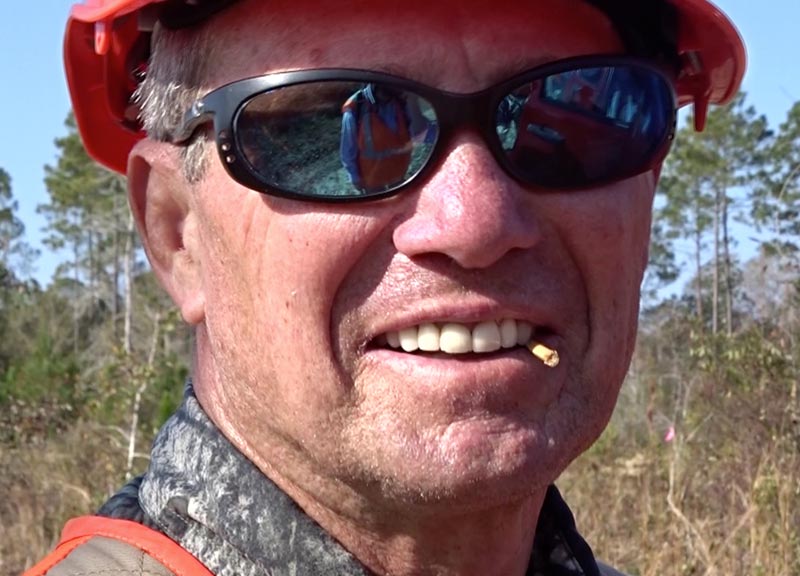
Opening a new hiking trail through the wilds of NW Florida is tough. The picture above shows what happened to a bushwhacking worker making a first cut along the proposed route in 2011. Briers tore his shirt and scratched his skin. The bump could be a mosquito bite. On December 13, 2016 the trail opened, officially 8.3 miles long. It offers the only public access to a special part of the Nokuse Plantation and Northwest Florida Water Management lands in the Florida panhandle.
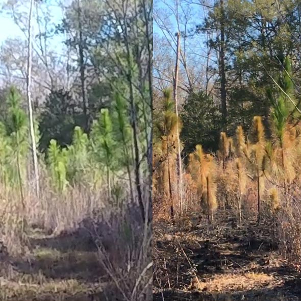
The first Florida Trail Association hike of the new trail split into two dates, based on water level assessment. The second picture on the right in 2017 shows green longleaf pines on January 14 when the river was at flood stage and the same area on February 4 after a controlled burn when the river had gone down.
Bruce Varner is the section lead carrying the project to completion and continuing to maintain it. Since dirt access roads go through private or controlled water management property, gates are locked. Getting in and out requires a 4WD truck and a Florida Trail Association (FTA) leader with the right keys.
The following entries follow a work-in-progress, the latest entry first (not chronological).
- First FTA Hike of the CRS Trail video on Vimeo by two FTA chapters on 1/14 and 2/4/2017 or YouTube. Additionally, see photos, hydrographs, and map.
- Cypress Creek: Where's the bridge? video and photos of three states: flooded, wet, and dry.
- Dec. 13, 2016 - Last work day before opening the new section video of four locations
- Cypress Creek Bridge work days' videos
- CRS Work Days in 2010 and 2011 - three videos
- November 13, 2016 parts of the section images and Mud Buddy Bridge
- November 11, 2016 parts of the section finished, F-Troop people. Slide show images of volunteer activity.
- November 14-21, 2015 Pine Log Gathering. Volunteers worked on the CRS. Videos linked from the Pine Log camping page.
- On June 6, 2015, National Trails Day, Choctawhatchee Chapter sponsored a hike on part of the trail.
- February, 2015 trail construction, rerouting, reflagging, repinning. F-Troop People. Movie of who was there on Vimeo: https://vimeo.com/album/2702825/video/119584724
- By December, 2014, the trail has been approved. Bruce Varner is the new section head. Where is the trail? Finding the decomposed flags on the GPS track is difficult. A work crew reflagged the trail on December 16 and 17, 2014. The next step is pinning to define the actual route starting January 5, 2015. This is step 7 in the countdown to trail opening as shown for the Eglin/Hwy 331 Expansion section. FTA volunteers also started a demo trail in preparation for F-troop Trail Construction on February 6-8, 2015. See Meetup work days: Pinning on Jan. 5, 2015 and following. Construction on Feb. 6, 2015 and following.
- As of June, 2011, the route exploration is complete. A GPS track of proposed route was submitted to the US Forest Service. Over Water and Roots, Measuring for Infrastructure is a Flash movie in the Pioneering of a Florida Trail series. See also a YouTube version.
I'm introducing the Pioneering of a Florida Trail with a choice of Flash or YouTube. This update is the second week and still is a work in progress on June 1, 2011. I should change the lettering. Missing is more about the timeline, steps involved in identifying the route, refining it, route adjustments at the request of the Forest Service and others, and then mapping it for submission to the Forest Service.
In this movie Caroling appears along with several people related to the project with brief text, followed by Ron, the section leader, giving an overview of the process.
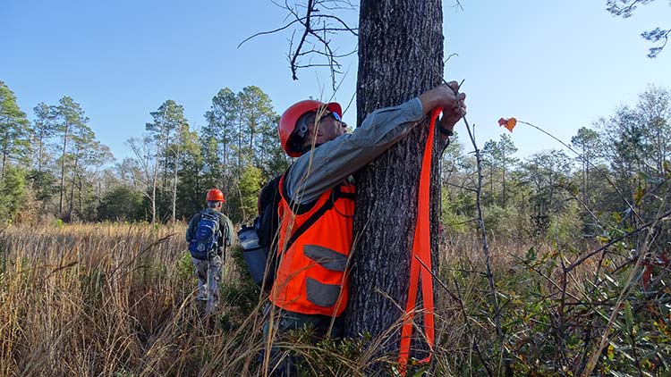
- Teaser trailer with a choice of Flash or YouTube, made May 18, 2011. This teaser trailer shows what it is like out there bushwhacking the hike, flagging the proposed route and measuring for infrastructure needs. Years ago MC Davis of the Nokuse Plantation donated the land. A legal corridor had to be designated setting the boundaries of the trail. The trail can also be Water Management District land where it is contingent, east of the corridor. The project involves maps, equipment, people, and organizations.
Trail workers are members of the Choctawhatchee chapter of the Florida Trail Association. They call themselves "trail hogs". Plans for each stage of action must pass through a liaison to the US Department of Forestry that oversees and supports the project.
- Also images from February 8, 2011.
These views of the Florida National Scenic Trail is from NW Florida, the panhandle. The proposed trail section stretches from SR 81 at Seven Runs to SR 20 west of the Choctawhatchee River. For general location, see this Google map. See also a working map of the trail. Note that the trail meanders in a narrow corridor authorized by the land managers (Nokuse Plantation and Water Management). Back to Florida National Scenic Trail views.
{wholeO Onward} ~ {Trips} ~ {Travel} ~ {Florida} ~ {Panhandle} ~ {Florida Trail}Send comments by clicking the ... link below:
lich...@wholeo.net